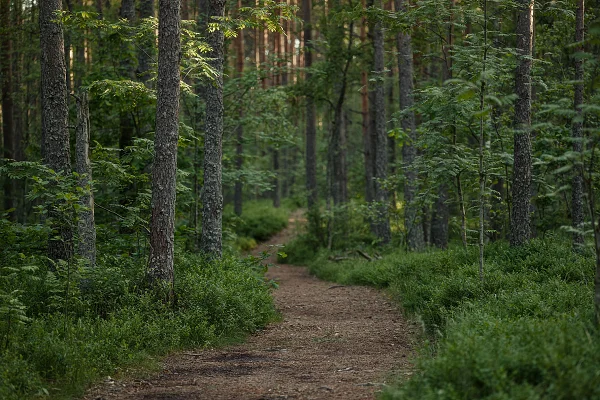
An interesting choice of tourist trails is one of Świeradów-Zdrój's greatest assets. Importantly, you can join them practically in the centre of the town, so we can set off in an extremely convenient and simple way to explore the most beautiful corners of the Izera Mountains. Which Świeradów trails are worth taking first? Where do they lead and what attractions will we encounter on them?
The colours of tourist trails – worth knowing!
Before we deal with the tourist trails in Świeradów-Zdrój that are worth taking, it is a good idea to address the matter of their colour markings. Contrary to a fairly common but, unfortunately, entirely mistaken belief, the colours do not at all indicate the difficulty level of a given walking trail. In reality they simply define the function of the trail. So how does this look in practice?
The meaning of tourist-trail colours:
- Red – this colour usually denotes the region's main tourist trail, treated as the most important, which may also be the most attractive in tourist terms.
- Blue – these are long trails, that is, long-distance routes.
- Green – a rather short trail, which usually leads to some characteristic places or viewpoints.
- Yellow – most often a transitional trail, connecting two other trails.
- Black – most often an approach trail, which lets you reach more important routes; it can be long-distance.
In Świeradów-Zdrój and the Izera Mountains there are trails marked with each of the above colours, so it is worth remembering what a given colour means. It does happen that along particular sections of the routes we will travel on two or three trails at once, because they run along the same path. In that situation we always keep to the trail that is meant to lead us to the previously chosen destination.
Where a given trail leads is also indicated by special markings on the route, usually placed at crossroads. They also contain information about the time it takes to reach particular points of the journey. So let us move on to which trails are a real must-have when exploring the Izera Mountains.
The Mieczysław Orłowicz Main Sudetes Trail – the red trail
If we are talking about Świeradów-Zdrój and the Izera Mountains and tourist routes, we cannot omit the most distinguished trail of the entire Sudetes, which begins in this very place. It is the Mieczysław Orłowicz Main Sudetes Trail, which runs from Świeradów-Zdrój at ul. Dworcowa 1 all the way to the railway station in Prudnik in the Opole Voivodeship. This trail is about 440 km long.
Of course, in its complete version it is not really dedicated to holidaymakers spending their leave in the Izera Mountains, because the estimated time to walk it one way is more than 120 hours. It must be noted, however, that a sizeable part of it leads through interesting Izera attractions – it is precisely this trail that takes you to Stóg Izerski or to the Wysoki Kamień hut, located on Wysoki Kamień – a peak of the High Ridge lying between Świeradów-Zdrój and Szklarska Poręba.
Red tourist trails in Świeradów-Zdrój
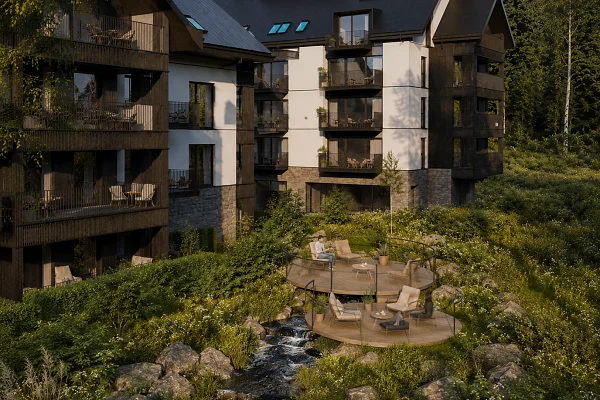
The Izera Park rental-management offer – find out the details:
Świeradów-Zdrój – Stóg Izerski – Świeradów-Zdrój – the red and blue trails
This is a great trail for the very beginning of an adventure with the Izera Mountains – fairly simple and relatively short. Most importantly, it is a loop trail, that is, we finish the journey where we started it, yet we walk along a different path almost the whole time, so it is not boring or monotonous.
The trail to Stóg Izerski (1,105 m above sea level), one of the highest peaks of the Izera Mountains, lying at the western end of the High Ridge, can be joined by the Spa Park, at the junction of ul. Parkowa and ul. Zdrojowa. We set off on the red and blue trails, which run parallel. After a moment we turn as the trail indicates and walk past the Spa House through the Park of the Polish Army Orchestras, past the Artificial Stalactite Grotto, heading for the water intake in Świeradów-Zdrój, from where we branch off on the red trail onto the New Izera Road, heading towards the Czeszka holiday house. There, next to the car park, is the descent onto the path leading – now along the red trail – to the summit of Stóg Izerski.
The time to walk the trail from the Spa Park and back takes about 4:16 h. We have a distance of 13.5 km to cover. Along the way we pass, among other things, the upper station of the gondola lift, the hut on Stóg Izerski, the Polish source of the Izera and Polana Izerska, where we branch off from the red onto the blue trail and head for one of the region's greatest attractions – the Sky Walk observation tower. It is therefore quite a pleasant trip, for at least half a day, or even a whole day if we want to enjoy the views and attractions of the area.
A trip to Stóg Izerski from Izera Park
Residents of Izera Park, meanwhile, can conveniently ride up to Stóg Izerski on the gondola lift, located just 300 metres from the complex, and then – travelling along the red and blue trails – make their loop heading to Polana Izerska and the Sky Walk observation tower, then heading to the Spa Park, where on ul. Spacerowa you can join the black trail, which will take us to the junction of ul. Źródlana and ul. Zakopiańska. In this configuration the route takes about 3:30 h (counting the ride up to Stóg Izerski by gondola lift – about 8 minutes) and has a distance of about 11 km.
Świeradów-Zdrój – Sępia Góra – Świeradów-Zdrój – the blue, green and yellow trails
A third interesting trail from Świeradów-Zdrój is the one leading to Sępia Góra (828 m above sea level) – this time a peak of the Kamienicki Ridge, lying on the other side of the town. If we want to make a larger loop, we will travel above all on two trails, the green and the blue (and for a while also the blue and the yellow).
The choice of route to the summit is free, although it must be borne in mind that the shorter blue route is a little more demanding than the longer green one, as it is very steep in places. Doing the whole loop – starting from ul. Dworcowa in Świeradów-Zdrój, then climbing Sępia Góra, passing Below Sępia Góra and returning to the starting point – takes about 2:20 h. The distance to cover is about 6.6 km.
You can, of course, choose one of the trails to both ascend and descend Sępia Góra. If we choose the shorter blue one, the time to cover the route one way will take about 1:12 h, with a distance of 2.4 km. In the case of the green route, from which at a certain point you have to branch off onto the yellow trail, an additional attraction is the chance to admire the reliefs created by a local artist, forming the Izera Calvary (Golgota Izerska). In this case the route one way takes about 1:47 h, with a distance of 4.4 km to cover.
The above routes are, of course, not the only ones worth taking when visiting the Izera Mountains, but they can be counted among the basic ones, which will allow you to get to know the beauty of the region while at the same time serving as an introduction to further exploration.